Carrauntoohil, Ireland - The Devil's Ladder
In this episode of Off You Pop, we head into the MacGillycuddy’s Reeks for a deep dive into the mountain behind the mountain — Carrauntoohil, Ireland’s highest peak at 3,407 feet, and its gateway shoulder, Cnoc na Toinne at 2,772 feet.
This episode is the world around the climb:
the geology older than the Atlantic, the Ice Age architecture of the Hag’s Glen, the legends of the Cailleach and Tuathal, and the human history that shaped the routes we walk today.
We explore the Old Red Sandstone that built the Reeks, the glacial corries carved into their sides, and the long wave‑shaped ridge of Cnoc na Toinne.
We look at the Devil’s Ladder — its folklore, its danger, and its place in Irish mountain culture.
And we talk about the iron cross on the summit: its origins in the 1970s, its rebuilds, its storms, its symbolism, and why touching that cold steel has become a rite of passage for so many hikers.
If you’ve climbed Carrauntoohil, this episode will feel like returning to a place you know.
If you haven’t, consider this your map to the stories written into the stone.
Off You Pop Unfiltered: The Photo Gallery
Episode Transcript
Introduction
This is Off You Pop, the podcast for hikers and adventurers who want to be epic in just one day. It's 2.30 in the morning in County Kerry. The owl and even the mountains seem to hold their breath. Today we're heading into the heart of the MacGillycuddy's Reeks,, climbing through darkness towards the highest point in Ireland. Carrauntoohil. 3,407 feet of old red sandstone, glacial architecture, and stories older than the language used to name it. And we'll pass over Cnoc na Toinne, the wave-shaped shoulder at 2,772 feet, the natural hinge between the Hags Glen and the upper world of the Reeks. This is the mountain behind the mountain, the geology, the legends, the human history, and the Iron Cross that's become one of the most recognizable silhouettes in Irish hiking. Now off your pop.
The Story of the Mountain
Carrauntoohil is built from old red sandstone, a rock formed between 410 and 350 million years ago, when Ireland sat near the equator. This wasn't a lush tropical world, it was a hot, dry river-cut desert. Iron in the sediment oxidized under the ancient sun, giving the reeks their deep purple-red color. Then came the ice age. Glaciers carved the Hags Glen into a classic U-shaped valley, gouged out of the quarries, and sharpened the ridges. The Eagle's Nest, that towering three-tiered amphitheatre, is a perfect example of glacial excavation. Above it, sits Loch Cummeanoughter the highest lake in Ireland, tucked into a bowl of rock. Like a secret the mountain keeps for itself. Cnoch na Toinne, by contrast, is made of well-bedded grey sandstone, smoother and more uniform. Its long ridge shapes match its name, Hill of the Wave. This is a landscape built by fire, sculpted by ice, and only recently walked by humans.
For most of Irish history, the Reeks weren't a playground. They were working mountains. Shepherds moved sheep through the Hag's Glen, farmers cut turf from the lower bogs, and the passes between peaks were used long before anyone thought of summiting anything. The name Hag's Glen, ties the valley to the Kalich, the ancient winter goddess who shapes mountains and weather. Place names like this are some of the oldest surviving cultural artifacts in Ireland. The Devil's Ladder, the steep gully between Carrauntoohil and Cnoch na Toinne, has been a traditional ascent route for generations. Its name may come from an old Irish curse. May the devil make a ladder of your backbone and pluck apples in the garden of hell. Whether that's the true origin or not, the ladder has earned its reputation. Steep, loose, and unforgiving.
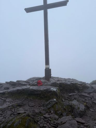
At the summit of Carrauntoohil sits the Iron Cross, one of the most iconic symbols in Irish hiking. The first version was erected in the 1970s, a simple wooden structure carried up by the mountain by local volunteers. It was replaced in the 80s with a sturdier steel cross, the one most hikers remember. Over the years it's been damaged by storms, repaired by the community, and even removed and replaced after an act of vandalism. The cross isn't ancient and isn't tied to a single legend, but it has become a cultural landmark, a marker of pilgrimage, challenge, and identity. For many hikers, reaching the summit and touching the cold metal is part of the ritual, a moment of arrival, a moment of recognition, a moment where the climb becomes a story. Whether you see it as a religious symbol, a historical artifact, or simply a piece of mountain culture,
Carrauntoohil's name, Corrán Tuathail,, translates to Tuathail's sickle. Some say it refers to the shape of the mountain. Others link it to Tuathail, a figure from early Irish mytho history, a king, a warrior, or a spirit name, depending on the source. The reeks are full of these echoes, the calich shaping storms, the devil's ladder testing climbers. The sense of the mountains are older than the story told about them. Even the geography feels mythic. Three great valleys radiating out of like spokes, three lakes stacked in the eagle's nest, and a summit that stands alone, watching the Atlantic weather roll in. This is a mountain where folklore and geology overlap, where the land fills a lies with memory. Carrauntoohil isn't the tallest mountain in Europe. It isn't the most technical, but it carries weight, culture, geological, emotional, that make it feel larger than its 3,407 feet. It's the mountain people climb when they want to test themselves. The mountain families talk about. The mountain that anchors the southwest of Ireland like a spine of stone. And Cnoc na Toinne that quiet shoulder at 2,772 feet, is the threshold. This is a place where farmers step out of the world of farms and valleys and into the high glacial architecture of the Reeks. This is a climb that stays with you, not because it's extreme, but because it's elemental. Now let's get On the Pop
On the Pop: My Journey
So to get to Carrauntoohil, you need to fly in to Cork and drive two hours down to the village of Glen Car. And on the way, you'll pass through quiet Irish villages and lanes that become narrower and narrower as you move down into the deep southwest of Ireland. For a short period you'll be on the Ring of Kerry, the classic tourist route, but only for a very short while. You quickly turn off into the narrow lanes, into the deep, deep Irish countryside. And I'd arrived at Cork about 4 p.m. Picked up a rental car and drove the two hours. And on my way I picked up some food at a local supermarket in order to supply for the next day's hike. As I was closing in on the village of Clencar, I came to the turnoff of Cronin's Yard, which is the trailhead for this hike. And it was only five kilometers away. So I took the turn off so I could scope out the trailhead before the hike. Now the lane there is impossibly narrow, just wide enough for one car, but it's short, and quickly you'll find yourself at a small cafe, which is Cronin's Yard, and a large parking lot that has a barrier at the front. I parked in front of the barrier and went into the cafe to try and make sure that I was able to park there at two in the morning because there was a sign at the gate that said no overnight parking. And the young lady in the cafe said that that was fine. And I asked about the two euro exit fee, and she was able to give me a two euro coin so that when it came time for me to leave in the morning, I'd be able to. And so from there, as I was leaving the cafe, I noticed a t-shirt on the wall, which was quite a prominition. It was a mount Toubkal in Morocco, a hike I'll be climbing later in the year. I thought that was a nice sign that this was the way.
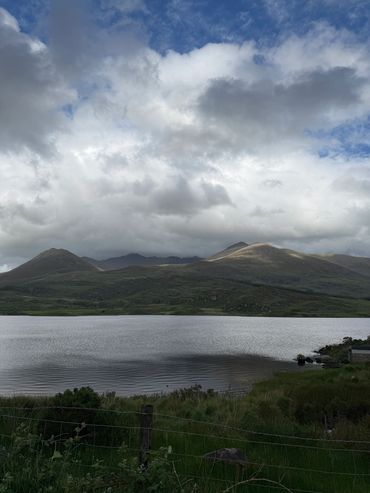
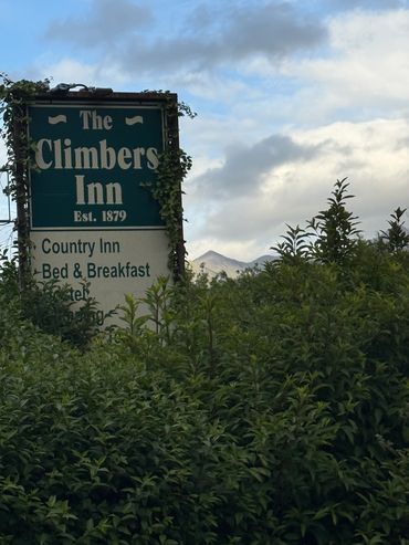
I got back in my car and began the 12-mile journey to my hotel for the evening, which was the climber's inn. And as you're driving back behind Carrauntoohil, you come to this beautiful lake that is just an amazing sight at the base of the MacGillycuddy's Reeks , with Carrauntoohil set off in the distance. And I couldn't resist but stop and enjoy the view of the mountain that I was about to climb. And it was truly a wonderful sight to see in the early evening light. I got back in my car and I quickly came across the climber's inn. It was really on the edge of the village, and I never did see the village because I just stopped at the climber's inn and that was going to be my base for the start in the for my early start in the morning. I went into the pub and there were hikers playing pool and sitting around, eating food, and at the bar, four or five locals conversing in Gaelic. I spoke to the barman and asked, told him who I was, and he took me up to my room. A small room in a separate building, sort of connected to the main inn, but intended purely for sleeping. I settled into my room, went to my car, got my stuff, got everything settled for the hike the next morning, and then went down to the bar to enjoy a meal. I had a pine of Guinness to help me sleep, and a steak sandwich to give me some energy for the next day. Then I went back up to my room to try to sleep. I thought it might be loud because it was attached to a bar, but it was quiet. And I tried to listen to some Gaelic music to set the mood and get me to sleep. But it took me a while. I don't think I eventually drifted off until 10.30, which was gonna be a problem, because I intended to start the next day at 1.30 a.m.
Before I knew it, the alarm was ringing, 1.30 a.m., and I was up. I quickly gathered my stuff, got into my car, and started the drive back to Cronin's Yard to start the hike. The landscape was impossibly dark, and you could see the stars through the clouds. And as you were as you're driving through these narrow country lanes in the dark, once in a while you'll see some of the local wildlife. There was a group of donkeys hanging out in a field, startled by my headlamps, and then a deer that decided it wanted to travel along the road with me for a short while before darting into the ferns and the hedgerows. And soon I was at that impossibly narrow lane to Cronin's Yard, making my way towards the start of the hike, and I was there - Cronin's Yard. I drove into the parking lot, parked up, got out of my car, and breathed in the early morning air. It was a little after 2 a.m. The night was crisp, and I was ready.
So I got my backpack on, began the climb. To start you walk across the parking lot, up back on the road, and behind the cafe at Cronin's Yard. The road continues for a very short way before terminating in a house, and there's a gate to your right that leads onto the trail. The trail is a dirt road, mostly of rock and dirt, and impossibly dark. And so all I could see was the cone and my headlamp. And as I'm starting the hike, I can see these white blotches up in front of me on the side of the road. And as I get closer, I can see through my headlamp beam that they're sheep, mostly female sheep with their new lambs, resting for the evening. And I wasn't sure what to make of them and how they'd react to me traipsing through them at this wee hour. But they largely stayed where they were and ignored me and gave me a look of indifference. So I kept hiking. But obviously in the small hamlet there were fences and fields. But very quickly, you take the road takes a right, and then a left through another gate, and you suddenly feel it. You're out of the farmland, and you are in the mountains. And I take a deep breath and I take it in, and I begin the hike. Now it's flat at this point. It's a wide, well-paved road, made with local stone, and it's easy walking. But within five or ten minutes, the weather had another idea. It started slowly to spit, and then started to rain quite steadily. And so quickly I took my pack off and donned my raincoat and put a weather protection on my pack. And then continued the hike. And as you're moving further and further away from Cronin's Yard, very slowly you start to grow in altitude, but nothing significant. And quickly you come across a green iron bridge that crosses a raging creek. And so you cross the iron bridge, it's steady, it's dedicated to a local person who I'm sure has done something wonderful for this piece of land. But I didn't read the signpost that was there. I was too eager to get up into the mountain. And once you cross this first green bridge across the creek, the trail begins to quickly rise. I can see in front of me a relatively short but steep set of stone stairs leading up into the wilderness. And I make short work of it, but it is definitely the first test of the day.
And when you sum it, and as you continue to walk, you begin to feel more and more isolated. And I come across more sheep, and there are sheep all over this mountain. But the sheep reminded me of a myth I'd read about, a local legend about not counting your sheep. The locals believe if you count your sheep, you're tempting fate, and you're likely to lose one of your sheep. So immediately I started counting sheep, and then I realized that I'm not a local and I don't own any sheep. But I continued on into the darkness along this wide road. It dipped a little, flattened a little, but then became more and more watery. There was clearly some streams running down the road, and from this point it was becoming more and more difficult uh to navigate. Now the road was still relatively flat, some slight ups and downs. Before I lost my way, I stopped and decided to check the navigation.
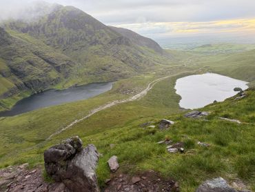
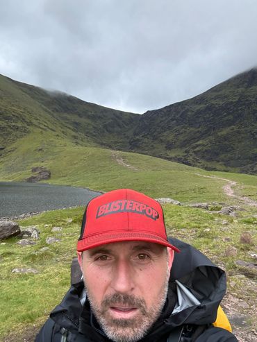
Now the mountains around me were starting to close in, and I could start to feel it, you know. You can just feel when the mountains are tall around you, and you can just make out the black silhouette of the mountains against the dark sky. And I checked my map and I was standing right in between the two lakes that sit in the bowl of the hags glan. To the left, the Loch Callee, the Hag's lake, with a little island in the middle that the hag is purported to live on. Now there's another myth related to the hag that if you go swimming at night in the Loch Callee, you could be sucked into the fairy underworld, which is an interesting little local myth. Then on the right is the goat lake, and it was good to see that I was still very much on trail and heading straight up towards the Devil's Ladder. The good thing about this trail is just keep going straight up into the mountain. That's where the trail goes. But in the darkness it became a little bit more confusing. And so I was starting to lose the trail a bit, finding myself sort of up side hilling a little bit, and sometimes up in the creek where I shouldn't have been, just because I started to lose where the trail was going in the darkness. At one point I reached a section where I was getting very much off trail into the into the grass and the bog. And the bog is sort of marked by these brown patches of earth that look like they're pretty solid to step on. But I learned very early on that you don't step on the brown patches because that is the peat bog. And lo and behold, I stood on one of these brown patches, and I immediately fell in up to my almost up to my knees. My foot went in and I was covered in in peat bog and uh got a little bit of a shock.
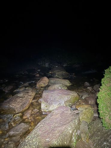
So after that point, I took a lot more care as I was navigating. And then my my point of reference was the creek. It became a lot narrower at this point, but it was it was a healthy creek you could hear rushing, rushing in the darkness. And so I tried to stick a lot nearer to the creek so I was maintaining the trail. Now I started to go uphill quite substantially and started to navigate away from the the creek at one point, and I realized with a quick navigation check that I was making my way up the up the zigzags, and this was my return path, so I had to double back a little bit in the dark back to the creek and keep following the creek. And as you keep going into the darkness, suddenly the creek gets a little bit more rugged and starts to go more sharply uphill. And you're there, you're at the start of the devil's ladder.
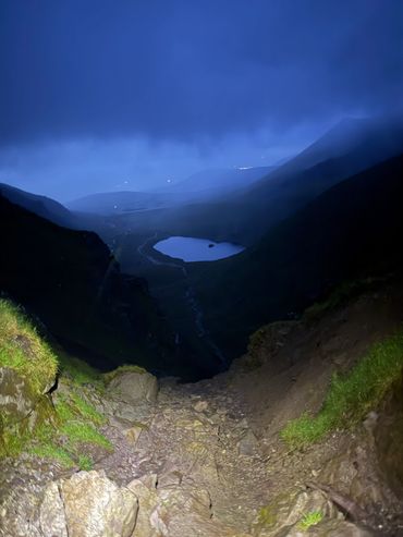
Now I can't see in the dark how daunting it is or how high it is. I just see the cone of the light in front of me. And the creek and the rock outcrops getting larger and more challenging to navigate. But I'm soon up into it. I'm standing at the base of this fantastic little gully that shoots you up into the air nearly a thousand feet. I think it's 886 feet ascent from this point. And the creek is running down it pretty heartily. It's running in between the rocks. There are different ways to go, as you see in the cone of the light. But you're basically scrambling at this point. And once in a while I'll hit a little patch that feels like it's the trail. There's sort of some little bit of compacted stone that I can sort of weave up every now and then. But often I'm off trail just on my climbing with my hands and my feet. Sometimes I need to put a knee up on a big boulder to make the next ascent, and it's just impossibly steep. And the rain is is hemming in and the creek is rushing beneath you. But it is such a spectacular experience to be there in the dark, making this spectacular ascent of up what is effectively a creek that's rushing down the hill. And as you climb higher and higher, you start getting into the blue zone. I can just way, way above me, I can see the saddle, the top of the of the devil's ladder. But it's it's a way to go. So I keep picking my way up and picking my way up. And eventually the stream comes down to a trickle, and you end up in this very narrow gully that's made of this sort of brown, compacted rock and clay, and it's just a short chute of about a hundred feet, and you can see the saddle. You're there, you're at the top of the devil's ladder, and you look back into the darkness, into the start, the the start of the light, and just see how impossibly far below you are the lakes.
And so as you get to the top of this little gully and this little chute, suddenly you pop up and you're on the saddle, and you're out of the Devil's Ladder, and you're on this green, lush, flat saddle, but it's misty. There's no visibility, there's a healthy wind, the rain is coming down, but you made it, and you look back down the devil's ladder, and you think, there's no way I'm going back down there that I just come up. It was so fun, but also sort of gnarly and dawning to look back down and think about even going back down that way. Um, so I took a breath, took a moment, and figured out the way to go. And so Carrauntoohil from this point is completely shrouded in mist. You can't see the top of it. I don't know how how high it is to get to the top. All I can really see is this flat grassy plain in front of me, and the mist, effectively the cloud level before me, in the darkness in the blue zone. So I I know roughly the direction I'm traveling.
So I start heading up towards Carrauntoohil, across this grassy plain, and once in a while there are a few of these boggy patches that I carefully navigate, hop over, or avoid. Very quickly, you find yourself at the base of the final ascent to Carrauntoohil, and it's a very, very different environment. It's this made of this very dark, purpley-gray, sort of slatey rock that's been that's been broken up that leads up to the peak of the mountain. And now there's a fairly well-defined trail. It's a bunch of switchbacks all the way to the top, and it's marked by these very large cairns, but it is very difficult to see from one cairn to the next through the mist. So you just start zigzagging your way up, up and up to the to the peak that you can't see, and so it seems like it's going on forever and ever. And once in a while, one of these huge cans pops in to remind you that you're still on the right trail, you're still going the right way, and it's a grind. You're going up and up and up, and then eventually you crest at the top of Carrauntoohil, and through the mist, you can just make out the steel cross, and it flattens out into this sort of final victory lap just to get to the very top, and you touch the cold steel cross, and there's a little stone shelter that's been built up there, and you stop and you look around, and you see this wonderful view of complete whiteout. No view whatsoever. And it's chilly up there, the wind is is whipping. You're standing in the dampness of the clouds. It's sort of raining, but really it's just the dampness of the of the clouds that you're standing in. So I hunker down in the shelter and take on a bit of fuel, bit of electrolytes, and just take a breath and a moment to enjoy the the ascent that I have made, and then back to it.
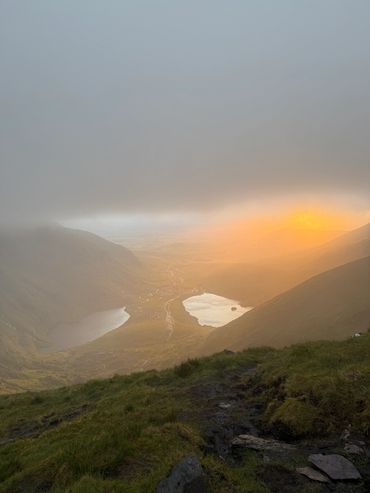
So back down out of the blue zone. Now it's starting to get light, so the headlamp can go away, and I can navigate fairly easily back down the zigzags. And so you're you're zigzagging back down, rock hopping down, down, down. And suddenly, as you get towards the bottom, you pop out of the clouds, and you're standing almost to the point where you can touch the clouds below you. The cloud level has just risen above the saddle. Now, Carrauntoohil behind you is still completely shrouded in cloud and mist, but the saddle, where the devil's ladder connects, is Is now daylight and the sun is just peeking out in the distance. And so now you get this fantastic view of the Hags Glen, the two lakes, the spectacular bowl, and then the Irish countryside sort of stretched out before you in this green, beautiful rolling hills into the distance. And it is such a spectacular sight. It makes that gnarly-narly little climb amazing. So I make my way across the grassy saddle again, avoiding the bogs, and get to the top of the Devil's Ladder, and now I see it in daylight. And wow, it just looks so dramatic. Looking down from that vantage point, back down into the devil's ladder. And then you see the goat lake on the left and the hag lake on the right, this beautiful bowl. It's just like the perfect picture of what you think Island should look like. I have the mountain to myself, nobody's up. It's just it's just at dawn. And now we have to make our way down.
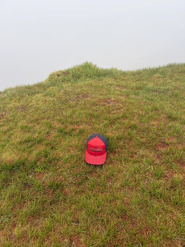
And the next peak to tackle is Cnoc na Toinne. And I'd read online it was just a sort of little hummock of grass. And what they don't tell you is actually it's a not insubstantial climb from the saddle. It's a fairly decent sized little climb. Now it's not the whole mountain, but it's got to be you know seven, eight hundred feet to get up the top. And there are these stepping stones through the grass. And Nochnatoin is grass covered. It's not rocky like Carrauntoohil. It's a completely different type of mountain. It's a more like a rounded hill that then leads into this wave, these waves of hills that lead down the ridge line. And I just start climbing up, sort of vaguely following the stepping stones. And wouldn't you know it, stick my foot in another patch of peety bog that goes up above my ankle and covers me and peat moss again. And I realize the stones that they've laid in the grass are there for a reason to stop you dunking your foot into the peat ball. So I start the ascent. My legs are feeling pretty good at this point. They're well warmed up. We ran fast pat down Carrauntoohil. And there's a little sheep there on the side of the hill. This and you can see in the distance the view of the hill. So and he poses for a photo. I think it's a female sheep, so I I call it Dorothy. Take the photo, then Dorothy turns around, lo and behold, Dorothy has horns, so it's more of a Dave, but first of many, many sheep on this hill. And make short work of Cnoc na Toinne. And when you get to the top, it's a very flat, grassy plain. There is no significant like this is this is the top of Cnoc na Toinne.
But you make it and make your way across the the top of the of the peak, and you're looking for the path down the zigzags. It's a bit of a confusing path towards the beginning. That's not the zigzags. You have to go 400-500 feet across the top of Cnoc na Toinne. When you will join up with the zigzags, and now it's not immediately zigzaggy. And what's interesting is it's also quite a gnarly drop because you're dropping back off Cnoc na Toinne at 2,776 feet and getting, you know, in the low 100 descent down back down the mountain. And the zigzags themselves, it's a fairly narrow path that's been carved into the side of this sort of steep, grassy hill. If you tried to go down the steep, grassy hill, you'll be you'll be tumbling and slip-sliding down. So the zigzags are the way to go. And the zigzags are made of this grey sandstone that is sort of fully tilted 90 degrees. And so it creates these little shelves that are fairly steep drop-offs every now and then. So although it's a fairly well-maintained path, every once in a while, it's a sort of drop-off and sort of jars your knees as you are stepping down every once in a while. And it starts out sort of traversing the hill back out towards you know and away from the from the hill, and then it starts zigzagging, sort of these endless zigzags down, down, down, down, down, down, down. It seems to go on forever. I'm getting fairly, fairly well into it. I see the biggest hair you ever see, and a big fat, plump hair sort of skipping through the grass, definitely well fed on this lush Irish mountain grass, and just continue making my way down. And as I get towards the bottom, I see that the trail is heading back towards the Devil's Ladder, and I find a little side trail to connect me more to the to the hags leg, to Loch Callee, make my way through the grass and the trail back to connect to that road.
And now it's obvious where the road is. It's daylight, I can see what's going on. But I just stop for a minute and look at the bowl that I'm in, this huge ring of the MacGillycuddy's Reeks. And the opposite side of the valley is just these dramatic green, jagged mountains with these thousand-foot waterfalls coming down off the side of the mountain. It's truly spectacular. And I look behind me and I look at the devil's ladder going up to the saddle and see how impossibly steep it is. But quickly I'm back on the flat road and the flat trail, and I want to make pretty good time. So I have another hill to climb later today. So I'm on a bit of a schedule. And so I start making my way back along the road, making good time as I'm chugging along. And as I'm traveling along the path, I come across these two big fat ravens hanging out beside the trail. And in Irish mythology, two ravens is good luck. So I took that as a as a good omen as I was trekking along the trail. And as you start to come out of the bowl, if you look up to the to the left, there's this triangular piece of rock sort of on one of the sides of the mountain. And it's called the hag's tooth. And apparently the myth is that the hag was trying to bite her way through the mountain or bit the mountain to create create the create the landscape. So it's quite an interesting sight to see. But you follow the the road back down, back into civilization, get back along the creek, across the bridges, back into the farmland, and eventually you're back at Cronin's Yard, and the hike is done. And as I get there, there's a couple of campers just starting to rise for the early morning. It's around 7 a.m. It's taken me about four and a half hours to do the round trip, which was pretty good. But what a spectacular, spectacular piece of landscape. Truly, I think, a bucket list hike. It's it's one that should 100% go on your list of the hikes you need to do before you die. It's just this gorgeous landscape. And that gnarly gnarly gnarly Devil's Ladder is just a a real great hiking experience. For anybody who who likes hiking, this is the type of thing you sort of live for. It's really a spectacular, spectacular hike. Anyway, that is Carrauntoohil. Now Off You Pop
This website uses cookies.
We use cookies to analyze website traffic and optimize your website experience. By accepting our use of cookies, your data will be aggregated with all other user data.